Sculpted deep within the rugged terrain of the Byndoor hinterlands, Koosalli Waterfalls—locally called Abbi Falls or Abbigundi by regional villagers—is a magnificent six-tiered natural wonder where the wild Sankadgundi stream breaks through the dense canopy of the Western Ghats. Plunging from a staggering cumulative height of roughly 470 feet, the water tears down a series of stepped rocky amphitheaters, creating an intense, thunderous roar that echoes across the isolated valley. Unlike standard single-drop falls, its charm lies in its sequence—featuring deep emerald rock pools nestled between tiers, most notably a striking pool at the fifth stage. Reaching it demands an adventurous trek traversing boulder-strewn stream paths and dense green foliage, preserving its status as a raw, off-the-grid sanctuary for true explorers.
ಉಡುಪಿ ಜಿಲ್ಲೆಯ ಬೈಂದೂರು ತಾಲ್ಲೂಕಿನ ದಟ್ಟ ಕಾಡಿನ ಮಧ್ಯೆ, ಪಶ್ಚಿಮ ಘಟ್ಟಗಳ ಮಡಿಲಲ್ಲಿ ಅಡಗಿರುವ ಕೋಸಳ್ಳಿ ಜಲಪಾತವು ಸಾಹಸ ಪ್ರಿಯರನ್ನು ಕೈಬೀಸಿ ಕರೆಯುವ ಸುಂದರ ನೈಸರ್ಗಿಕ ತಾಣವಾಗಿದೆ. ಇಲ್ಲಿಂದ ಹರಿಯುವ ನದಿ ಹಾಗೂ ಸ್ಥಳೀಯ ತೊರೆಯು ಸಂಕಡಗುಂಡಿ ಎಂದೇ ಸ್ಥಳೀಯವಾಗಿ ಪ್ರಸಿದ್ಧವಾಗಿದೆ. ಒಂದರ ಮೇಲೊಂದರಂತೆ ಧುಮುಕುವ ಹಂತಗಳನ್ನು ಹೊಂದಿರುವ ಈ ಜಲಪಾತದ ಬಳಿಗೆ ತಲುಪಲು ದಟ್ಟ ಹಸಿರು ಕಾಡಿನ ನಡುವೆ ಸುಮಾರು ಮೂರರಿಂದ ನಾಲ್ಕು ಕಿಲೋಮೀಟರ್ ದೂರದವರೆಗೆ ಸಾಹಸಮಯ ಚಾರಣ (Trekking) ಮಾಡಬೇಕಾಗುತ್ತದೆ.
ಮಳೆಗಾಲ ಹಾಗೂ ಚಳಿಗಾಲದ ಅವಧಿಯಲ್ಲಿ ಇಲ್ಲಿ ನೀರಿನ ರಭಸ ಅಧಿಕವಾಗಿದ್ದು, ಜಲಪಾತದ ಸೌಂದರ್ಯ ನೂತನ ಕಳೆಗಟ್ಟುತ್ತದೆ. ಇಲ್ಲಿನ ಕಡಿದಾದ ಬಂಡೆಗಳು, ಮರಗಿಡಗಳು ಹಾಗೂ ಹಕ್ಕಿಗಳ ನಿನಾದವು ಪ್ರವಾಸಿಗರಿಗೆ ವಿಶಿಷ್ಟವಾದ ಕಾಡಿನ ಅನುಭವವನ್ನು ನೀಡುತ್ತದೆ. ದುರ್ಗಮವಾದ ಕಾದಾರಣ್ಯ ಹಾಗೂ ಜಾರುಬಂಡೆಗಳ ಹಾದಿಯಿರುವ ಕಾರಣ, ಇಲ್ಲಿಗೆ ಭೇಟಿ ನೀಡುವವರು ಮುಂಜಾಗ್ರತಾ ಕ್ರಮವಾಗಿ ಸ್ಥಳೀಯ ಮಾರ್ಗದರ್ಶಕರ (Guide) ಸಹಾಯವನ್ನು ಪಡೆದುಕೊಳ್ಳುವುದು ಅತ್ಯಂತ ಸುರಕ್ಷಿತವಾಗಿದೆ.
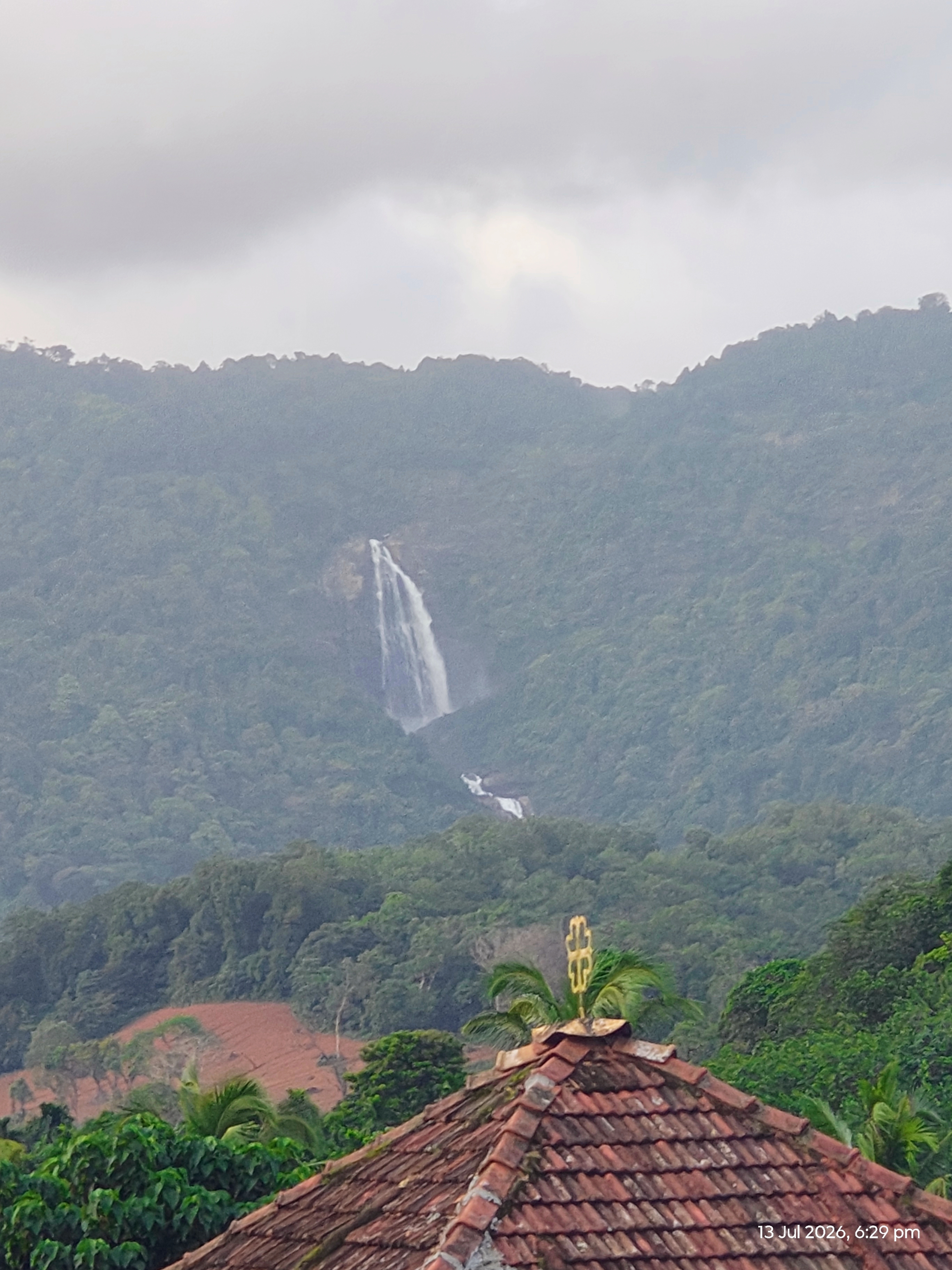
Koosalli Waterfalls is one of the wild and less-developed natural attractions of Byndoor taluk, hidden among the forests and rocky terrain of the Western Ghats near Koosalli village. Unlike easily accessible waterfalls where you can drive almost to the viewpoint, Koosalli is part of the journey itself. Reaching the falls involves walking through forest, streams and uneven rocky ground.
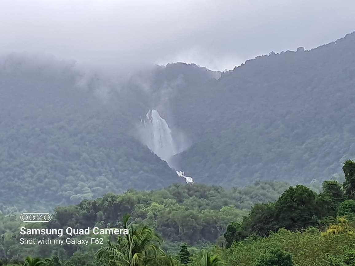
The waterfall descends through six natural stages with total height of 381ft giving Koosalli a distinctive appearance. The entire cascade drops from a considerable height, with the upper sections disappearing into the surrounding forest. From a distance, the white water cutting through the dark green hillside is particularly striking during the rainy season.
This waterfalls ranked 8th highest waterfalls of Karnataka in terms of height.
The approach to Koosalli is an important part of the experience. The 4km trekking route passes through dense forest and hilly terrain, with streams and rocky sections along the way. In places, visitors follow the natural watercourse towards the waterfall.
The walk becomes more demanding as you get closer to the higher sections. The rocks can be uneven and slippery, particularly after rain, so Koosalli is better suited to visitors who are comfortable with a forest trek rather than those looking for an easy sightseeing spot.
A local guide who knows the route is useful, especially for first-time visitors. The forest can make the trail difficult to identify in some sections, and the upper stages require considerably more care than the lower viewpoint.
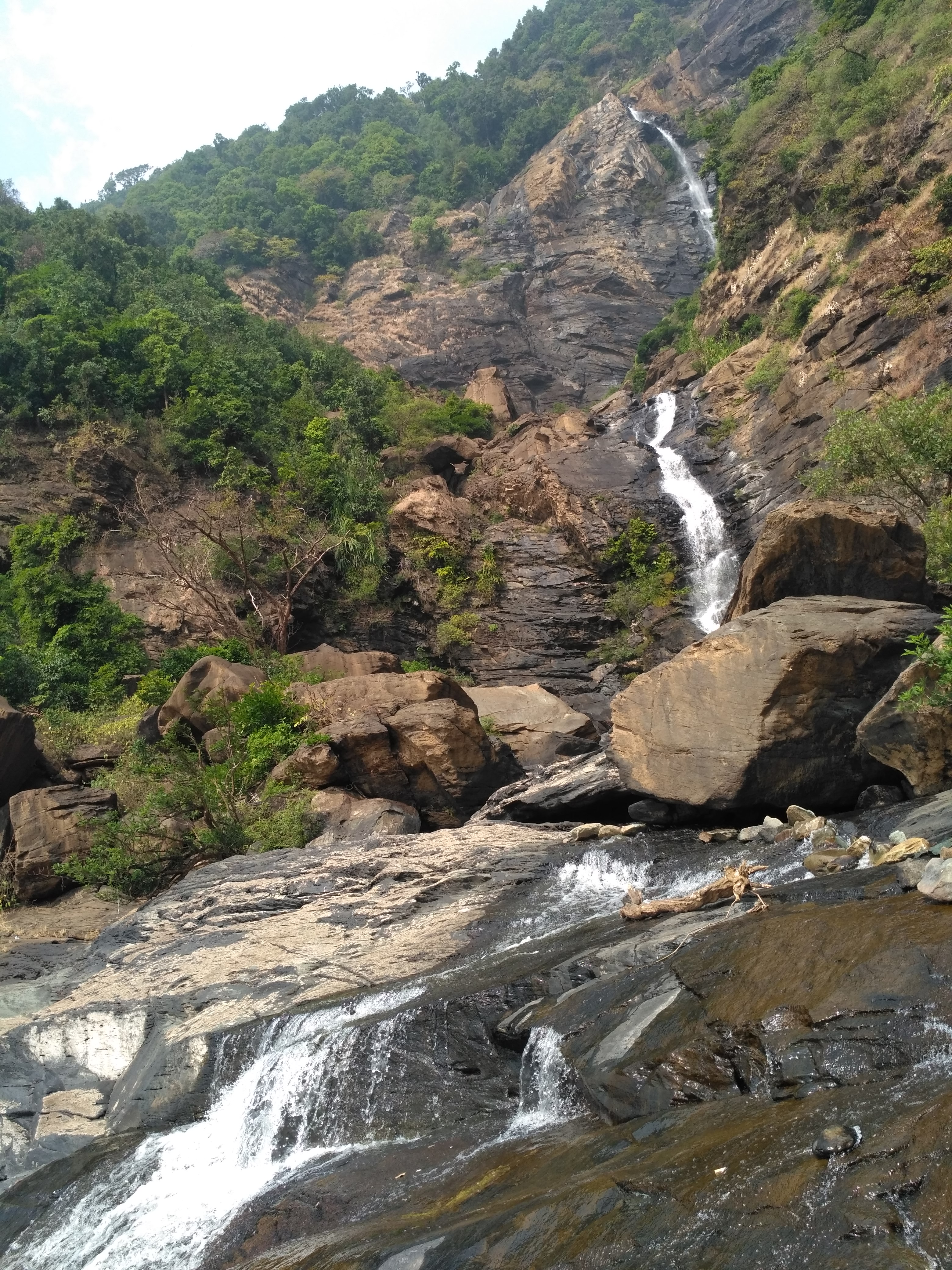
Koosalli is not a single straight drop. Water travels down the hillside through six successive cascades.
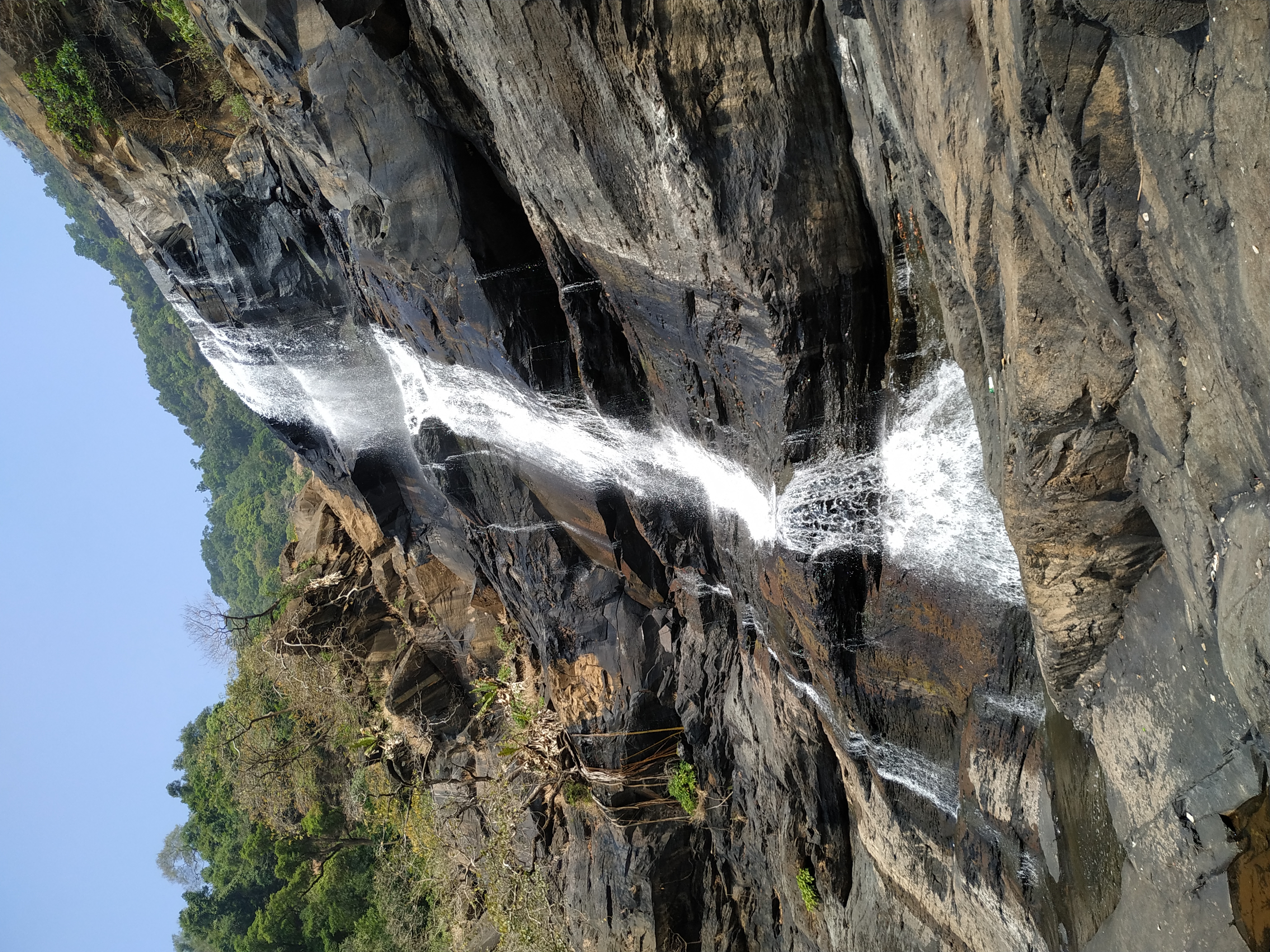
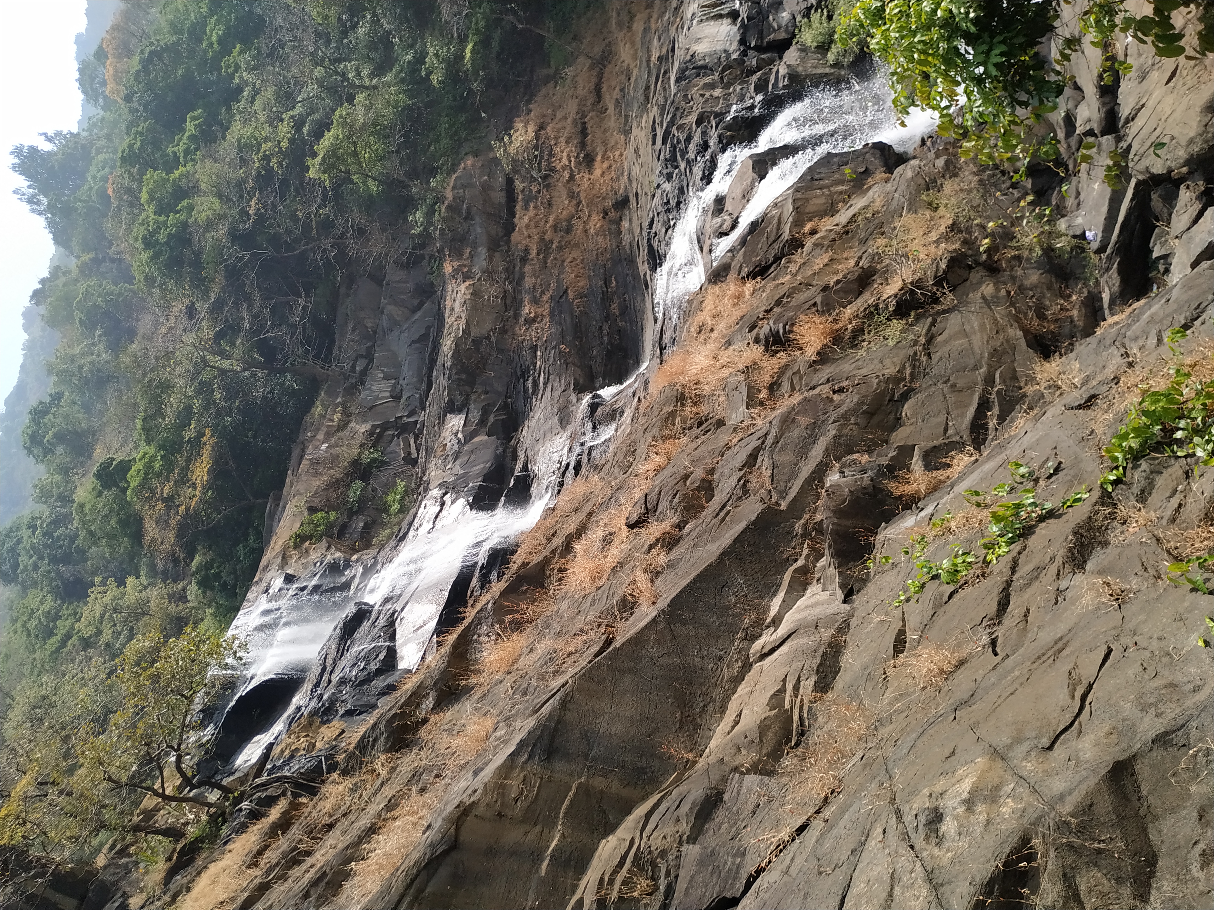
The lower sections are comparatively easier to approach, while reaching the higher levels requires more difficult movement over rocks. The fifth level has a naturally formed deep pool, adding another interesting feature to the waterfall landscape.
Because of the terrain, many visitors are satisfied with experiencing the lower and middle sections rather than attempting every level.
The monsoon completely changes the character of the waterfall.
When the Western Ghats receive heavy rainfall, the streams feeding Koosalli become stronger and the six cascades carry much more water. The surrounding forest also becomes intensely green, making the waterfall look particularly impressive.
At the same time, this is when the rocks and stream crossings become most slippery. Strong water flow can also make some sections unsafe. The safest approach is to avoid entering the water or attempting difficult climbs when conditions are poor.
Koosalli is best experienced by people who enjoy trekking, forests and untouched natural surroundings. There are no large tourist facilities surrounding the waterfall, and that is part of its appeal.
The walk takes you through a landscape of tall trees, small streams, rocks and the sounds of birds and flowing water. By the time you reach the waterfall, the surroundings feel far removed from the busy coastal highway.
The destination therefore offers something different from the beaches and viewpoints of Byndoor: here, the attraction is the forest journey and the waterfall itself.
Koosalli is also associated with Kudumari Waterfalls, another waterfall in the same broader forest region. The two destinations can be considered together by travellers planning an adventure-focused trip, although each requires its own approach and sufficient time.
Both falls water is joining to same river Sankadgundi river in Toodhalli.
Koosalli is particularly known for its multi-level cascade, while Kudumari has its own distinct waterfall landscape.
The waterfall has water through much of the year, but the monsoon and the months immediately following it bring the strongest flow and the greenest surroundings. For trekking, conditions after the peak monsoon can be more manageable than during periods of continuous heavy rain.
Visitors should plan enough time for the trek rather than treating Koosalli as a quick roadside stop.
Koosalli is located near Koosalli village in Byndoor taluk. The approach traditionally involves travelling towards the interior from the Shiroor side and continuing through the smaller roads towards the forest. The final portion is on foot.
The exact trekking approach can vary with local conditions, forest access and seasonal changes, so visitors should check the current route locally before starting the walk.
Koosalli is special because it has remained a forest waterfall rather than a heavily developed tourist attraction. The six-stage cascade, dense Western Ghats vegetation, streams and rocky trail give the place an adventurous character.
For someone exploring Byndoor beyond its beaches and temples, Koosalli offers a completely different experience—a journey into the forest ending at a spectacular natural waterfall hidden in the hills.
ಕೊಸಳ್ಳಿ ಜಲಪಾತ
ಬೈಂದೂರು ತಾಲೂಕಿನ ಪಶ್ಚಿಮ ಘಟ್ಟದ ತಪ್ಪಲಿನಲ್ಲಿ, ಕಾಡು ಮತ್ತು ಬೆಟ್ಟಗಳ ನಡುವೆ ಅಡಗಿರುವ ಸುಂದರ ಜಲಪಾತವೇ ಕೊಸಳ್ಳಿ ಜಲಪಾತ. ಕರಾವಳಿಯ ಸಮತಟ್ಟಾದ ಪ್ರದೇಶದಿಂದ ಪಶ್ಚಿಮ ಘಟ್ಟದ ಕಡೆಗೆ ಸಾಗಿದಂತೆ ಭೂಪ್ರದೇಶದ ಸ್ವರೂಪ ಬದಲಾಗುತ್ತಾ ಹೋಗುತ್ತದೆ. ಬೆಟ್ಟದ ಇಳಿಜಾರು, ದಟ್ಟ ಹಸಿರು ಮತ್ತು ಕಲ್ಲಿನ ಪ್ರದೇಶಗಳ ನಡುವೆ ಕೊಸಳ್ಳಿ ಜಲಪಾತ ಕಾಣಿಸಿಕೊಳ್ಳುತ್ತದೆ.
ಕೊಸಳ್ಳಿ ಜಲಪಾತದ ವಿಶೇಷತೆ ದೊಡ್ಡ ಪ್ರವಾಸಿ ತಾಣದ ಗದ್ದಲದಲ್ಲಿಲ್ಲ. ಪ್ರಕೃತಿಯ ಮಧ್ಯೆ, ಕಾಡಿನೊಳಗೆ ತನ್ನದೇ ಆದ ಸ್ವರೂಪದಲ್ಲಿ ಇರುವುದೇ ಇದರ ಆಕರ್ಷಣೆ. ಜಲಪಾತವನ್ನು ತಲುಪಿದಾಗ ಸುತ್ತಲೂ ಕಾಣುವ ಕಲ್ಲಿನ ಬಂಡೆಗಳು, ಹಸಿರು ಬೆಟ್ಟಗಳು ಮತ್ತು ನೀರಿನ ಹರಿವು ಸೇರಿ ಪಶ್ಚಿಮ ಘಟ್ಟದ ನೈಸರ್ಗಿಕ ಸೌಂದರ್ಯವನ್ನು ಚೆನ್ನಾಗಿ ತೋರಿಸುತ್ತವೆ.
ಮಳೆಗಾಲದಲ್ಲಿ ಪಶ್ಚಿಮ ಘಟ್ಟದ ಬೆಟ್ಟಗಳಲ್ಲಿ ನೀರಿನ ಹರಿವು ಹೆಚ್ಚಾದಾಗ ಕೊಸಳ್ಳಿ ಜಲಪಾತವೂ ತನ್ನ ಸಂಪೂರ್ಣ ಸ್ವರೂಪವನ್ನು ಪಡೆಯುತ್ತದೆ. ಬೆಟ್ಟದ ಮೇಲಿನಿಂದ ಹರಿದು ಬರುವ ನೀರು ಕಲ್ಲಿನ ಇಳಿಜಾರನ್ನು ದಾಟಿ ಕೆಳಕ್ಕೆ ಧುಮ್ಮಿಕ್ಕುತ್ತದೆ.
ಮಳೆ ಹೆಚ್ಚಿರುವ ಸಮಯದಲ್ಲಿ ಜಲಪಾತದ ಸದ್ದು ದೂರದಿಂದಲೇ ಕೇಳಿಸುತ್ತದೆ. ಸುತ್ತಲಿನ ಕಾಡು ದಟ್ಟ ಹಸಿರಿನಿಂದ ತುಂಬಿರುವುದರಿಂದ ಬಿಳಿಯಾಗಿ ಬೀಳುವ ನೀರು ಹಸಿರು ಮತ್ತು ಕಪ್ಪು ಕಲ್ಲಿನ ನಡುವೆ ಇನ್ನಷ್ಟು ಎದ್ದು ಕಾಣುತ್ತದೆ.
ಮಳೆ ಕಡಿಮೆಯಾದ ನಂತರ ನೀರಿನ ಹರಿವು ನಿಧಾನವಾಗುತ್ತಾ ಬಂದರೂ, ಜಲಪಾತದ ಸುತ್ತಲಿನ ಕಾಡಿನ ವಾತಾವರಣ ಮತ್ತು ಬೆಟ್ಟದ ದೃಶ್ಯ ತನ್ನ ಸೌಂದರ್ಯವನ್ನು ಉಳಿಸಿಕೊಂಡಿರುತ್ತದೆ.
ಕೊಸಳ್ಳಿ ಜಲಪಾತಕ್ಕೆ ಹೋಗುವಾಗ ಕೇವಲ ಜಲಪಾತವನ್ನು ನೋಡುವುದಕ್ಕೆ ಸೀಮಿತವಾಗದೆ ಸುತ್ತಲಿನ ಪ್ರಕೃತಿಯನ್ನು ಗಮನಿಸಿದರೆ ಈ ಪ್ರದೇಶದ ವಿಶೇಷತೆ ಹೆಚ್ಚು ಅರ್ಥವಾಗುತ್ತದೆ.
ದೊಡ್ಡ ಮರಗಳು, ಕಾಡು ಸಸ್ಯಗಳು, ಬಳ್ಳಿಗಳು, ಕಲ್ಲಿನ ಇಳಿಜಾರುಗಳು ಮತ್ತು ಸಣ್ಣ ನೀರಿನ ಹರಿವುಗಳು ದಾರಿಯುದ್ದಕ್ಕೂ ಕಾಣಿಸುತ್ತವೆ. ಮಳೆಗಾಲದಲ್ಲಿ ಹಸಿರು ಇನ್ನಷ್ಟು ದಟ್ಟವಾಗುತ್ತದೆ. ಕೆಲವೆಡೆ ಮರಗಳ ನಡುವೆ ಸೂರ್ಯನ ಬೆಳಕು ಬೀಳುವ ರೀತಿ, ಇನ್ನೂ ಕೆಲವೆಡೆ ಸಂಪೂರ್ಣ ನೆರಳಿನಿಂದ ಕೂಡಿದ ಕಾಡಿನ ಹಾದಿ — ಇವೆಲ್ಲವೂ ಚಾರಣದ ಅನುಭವವನ್ನು ವಿಭಿನ್ನವಾಗಿಸುತ್ತವೆ.
ಇಂತಹ ಕಾಡಿನ ಪ್ರದೇಶಗಳಲ್ಲಿ ಪ್ರಕೃತಿಯ ಶಬ್ದವೇ ಮುಖ್ಯ. ಪಕ್ಷಿಗಳ ಧ್ವನಿ, ಎಲೆಗಳ ಸದ್ದು ಮತ್ತು ನೀರು ಹರಿಯುವ ಶಬ್ದದ ನಡುವೆ ಸಾಗುವುದು ನಗರ ಪ್ರದೇಶದ ಪ್ರವಾಸಕ್ಕಿಂತ ಸಂಪೂರ್ಣ ಬೇರೆ ಅನುಭವ.
ಕೊಸಳ್ಳಿ ಜಲಪಾತದ ಮತ್ತೊಂದು ಪ್ರಮುಖ ವೈಶಿಷ್ಟ್ಯವೆಂದರೆ ಇಲ್ಲಿಗೆ ತಲುಪುವ ದಾರಿ. ವಾಹನದಲ್ಲಿ ನೇರವಾಗಿ ಜಲಪಾತದ ಬಳಿಗೆ ಹೋಗಿ ಇಳಿಯುವ ರೀತಿಯ ಪ್ರವಾಸಿ ತಾಣವಲ್ಲ ಇದು.
ಕಾಡಿನ ಹಾದಿಯಲ್ಲಿ ನಡೆದು, ಬೆಟ್ಟದ ಪ್ರದೇಶವನ್ನು ದಾಟುತ್ತಾ ಮುಂದೆ ಸಾಗಬೇಕು. ದಾರಿಯ ಸ್ವರೂಪ ಸ್ಥಳ ಮತ್ತು ಋತುವಿಗೆ ಅನುಗುಣವಾಗಿ ಬದಲಾಗಬಹುದು. ಮಳೆಗಾಲದಲ್ಲಿ ಮಣ್ಣು ಮತ್ತು ಕಲ್ಲುಗಳು ಒದ್ದೆಯಾಗಿರುವುದರಿಂದ ಹಾದಿ ಹೆಚ್ಚು ಜಾರುವಂತಿರುತ್ತದೆ.
ಆದರೆ ಈ ನಡಿಗೆಯೇ ಕೊಸಳ್ಳಿ ಜಲಪಾತದ ಪ್ರವಾಸವನ್ನು ವಿಶೇಷವಾಗಿಸುತ್ತದೆ. ದಾರಿಯುದ್ದಕ್ಕೂ ಜಲಪಾತದ ಸದ್ದು ನಿಧಾನವಾಗಿ ಹತ್ತಿರವಾಗುತ್ತಾ ಬರುತ್ತದೆ. ಕೊನೆಗೆ ಮರಗಳ ನಡುವೆ ಜಲಧಾರೆ ಕಾಣಿಸುವಾಗ, ಇಷ್ಟು ದೂರ ನಡೆದದ್ದಕ್ಕೆ ಸಿಗುವ ಪ್ರತಿಫಲದ ಅನುಭವವಾಗುತ್ತದೆ.
ಕೊಸಳ್ಳಿ ಜಲಪಾತವನ್ನು ಅದರ ಅತ್ಯಂತ ಜೀವಂತ ರೂಪದಲ್ಲಿ ನೋಡಬೇಕೆಂದರೆ ಮಳೆಗಾಲದ ನಂತರದ ಪ್ರಕೃತಿ ವಿಶೇಷವಾಗಿರುತ್ತದೆ. ಪಶ್ಚಿಮ ಘಟ್ಟದಲ್ಲಿ ಸುರಿಯುವ ಮಳೆಯ ನೀರು ಬೆಟ್ಟದ ಸಣ್ಣ ತೊರೆಗಳು ಮತ್ತು ಜಲಧಾರೆಗಳನ್ನು ತುಂಬಿಸುತ್ತದೆ.
ಈ ಸಮಯದಲ್ಲಿ ಸುತ್ತಲಿನ ಕಾಡು ಹೊಸ ಹಸಿರಿನಿಂದ ತುಂಬಿರುತ್ತದೆ. ಕಲ್ಲಿನ ಮೇಲೂ ನೀರು ಹರಿಯುವುದರಿಂದ ದಾರಿಯ ಸ್ವರೂಪ ಬದಲಾಗುತ್ತದೆ. ಜಲಪಾತದ ಹರಿವು ಹೆಚ್ಚಾಗುವುದರಿಂದ ಅದರ ಸದ್ದು ಮತ್ತು ದೃಶ್ಯ ಎರಡೂ ಗಮನ ಸೆಳೆಯುತ್ತವೆ.
ಆದರೆ ಇದೇ ಸಮಯದಲ್ಲಿ ಜಲಪಾತದ ಸುತ್ತಲಿನ ಕಲ್ಲುಗಳು ತುಂಬಾ ಜಾರುವ ಸಾಧ್ಯತೆ ಇರುವುದರಿಂದ ನೀರಿನ ಹತ್ತಿರ ಹೋಗುವಾಗ ಎಚ್ಚರಿಕೆ ಅಗತ್ಯ. ಪ್ರಕೃತಿಯ ನಡುವೆ ಇರುವ ಜಲಪಾತವಾದ್ದರಿಂದ ಸುರಕ್ಷಿತ ಸ್ಥಳದಲ್ಲೇ ನಿಂತು ದೃಶ್ಯವನ್ನು ಆನಂದಿಸುವುದು ಉತ್ತಮ.
ಮಳೆಗಾಲದ ಕೊಸಳ್ಳಿ ಮತ್ತು ಬೇಸಿಗೆಯ ಕೊಸಳ್ಳಿ ಒಂದೇ ರೀತಿ ಕಾಣುವುದಿಲ್ಲ. ಮಳೆಯ ಪ್ರಮಾಣ ಕಡಿಮೆಯಾದಂತೆ ನೀರಿನ ಹರಿವು ಸಹ ನಿಧಾನವಾಗುತ್ತದೆ. ಆದರೆ ಕಲ್ಲಿನ ಬಂಡೆಗಳು, ಬೆಟ್ಟದ ಇಳಿಜಾರು ಮತ್ತು ಕಾಡಿನ ಸ್ವರೂಪ ಸ್ಪಷ್ಟವಾಗಿ ಕಾಣಿಸಿಕೊಳ್ಳುತ್ತದೆ.
ನೀರಿನ ಪ್ರಮಾಣ ಕಡಿಮೆಯಾದಾಗ ಜಲಪಾತದ ರಚನೆಯನ್ನೂ ಹತ್ತಿರದಿಂದ ಗಮನಿಸಬಹುದು. ಯಾವ ದಿಕ್ಕಿನಿಂದ ನೀರು ಬರುತ್ತದೆ, ಕಲ್ಲಿನ ಮೇಲ್ಮೈಯಲ್ಲಿ ಅದು ಹೇಗೆ ಹರಿಯುತ್ತದೆ ಮತ್ತು ಕೆಳಭಾಗದಲ್ಲಿ ಹೇಗೆ ಸೇರುತ್ತದೆ ಎಂಬುದು ಹೆಚ್ಚು ಸ್ಪಷ್ಟವಾಗಿ ಕಾಣುತ್ತದೆ.
ಕೊಸಳ್ಳಿ ಜಲಪಾತವು ಪ್ರಕೃತಿ ಛಾಯಾಗ್ರಹಣಕ್ಕೆ ಉತ್ತಮ ಹಿನ್ನೆಲೆ ನೀಡುತ್ತದೆ. ಜಲಪಾತದ ನೀರು, ಕಪ್ಪು ಕಲ್ಲುಗಳು, ದಟ್ಟ ಹಸಿರು ಮತ್ತು ಬೆಟ್ಟದ ಇಳಿಜಾರುಗಳು ಒಂದೇ ದೃಶ್ಯದಲ್ಲಿ ಸಿಗುತ್ತವೆ.
ಮಳೆಗಾಲದಲ್ಲಿ ಜಲಪಾತದ ಹರಿವು ಹೆಚ್ಚಿರುವಾಗ ತೆಗೆದ ಚಿತ್ರಗಳು ಒಂದು ರೀತಿಯ ಸೊಬಗನ್ನು ನೀಡಿದರೆ, ಮಳೆ ನಂತರದ ಹಸಿರು ಕಾಡಿನ ನಡುವೆ ಕಾಣುವ ಜಲಧಾರೆ ಮತ್ತೊಂದು ರೀತಿಯ ದೃಶ್ಯವನ್ನು ನೀಡುತ್ತದೆ.
ಆದರೆ ಇಲ್ಲಿ ಫೋಟೋ ತೆಗೆದುಕೊಳ್ಳುವುದಕ್ಕಿಂತ ಮೊದಲು ಕಾಡಿನ ದಾರಿ ಮತ್ತು ಕಲ್ಲಿನ ಪ್ರದೇಶದ ಸುರಕ್ಷತೆಯನ್ನು ಗಮನಿಸುವುದು ಮುಖ್ಯ.
ಕೊಸಳ್ಳಿ ಇರುವ ಪ್ರದೇಶ ಪಶ್ಚಿಮ ಘಟ್ಟದ ನೈಸರ್ಗಿಕ ಪರಿಸರದ ಭಾಗವಾಗಿದೆ. ಕರಾವಳಿಯ ಬಿಸಿಲು ಮತ್ತು ತೆರೆದ ಪ್ರದೇಶದಿಂದ ಕೆಲವು ದೂರ ಸಾಗಿದಾಗ ಇಲ್ಲಿನ ವಾತಾವರಣದಲ್ಲಿ ತೇವಾಂಶ, ಹಸಿರು ಮತ್ತು ಬೆಟ್ಟದ ಪ್ರಭಾವ ಹೆಚ್ಚಾಗುತ್ತದೆ.
ಇಲ್ಲಿನ ಕಾಡು ಹಲವಾರು ಸಣ್ಣ ಜೀವಿಗಳು, ಪಕ್ಷಿಗಳು ಮತ್ತು ಕಾಡು ಸಸ್ಯಗಳಿಗೆ ಆಶ್ರಯವಾಗಿದೆ. ಅದಕ್ಕಾಗಿ ಜಲಪಾತಕ್ಕೆ ಹೋಗುವಾಗ ಕಾಡಿನ ಮೌನವನ್ನು ಕಾಪಾಡುವುದು ಮತ್ತು ಯಾವುದೇ ತ್ಯಾಜ್ಯವನ್ನು ಬಿಟ್ಟುಬರದಿರುವುದು ಬಹಳ ಮುಖ್ಯ.
ಬೈಂದೂರು ಭಾಗದಲ್ಲಿ ಹಲವು ಜಲಪಾತಗಳು ಮತ್ತು ಪ್ರಕೃತಿ ತಾಣಗಳಿದ್ದರೂ, ಕೊಸಳ್ಳಿಯ ವಿಶೇಷತೆ ಅದರ ಕಾಡಿನೊಳಗಿನ ಸ್ವರೂಪ ಮತ್ತು ಚಾರಣದ ಅನುಭವ. ಇಲ್ಲಿ ಜಲಪಾತವನ್ನು ನೋಡಲು ಮಾತ್ರ ಹೋಗುವುದಿಲ್ಲ; ಕಾಡಿನ ದಾರಿಯಲ್ಲಿ ನಡೆದು, ಬೆಟ್ಟದ ಪರಿಸರವನ್ನು ದಾಟಿ, ಕೊನೆಗೆ ಜಲಧಾರೆಯನ್ನು ತಲುಪುವುದು ಪ್ರವಾಸದ ಒಂದು ಭಾಗ.
ಕರಾವಳಿಯಿಂದ ಪಶ್ಚಿಮ ಘಟ್ಟದ ಕಡೆಗೆ ಸಾಗಿದಾಗ ಬದಲಾಗುವ ಪ್ರಕೃತಿಯನ್ನು ಕೊಸಳ್ಳಿ ಜಲಪಾತದ ಪ್ರಯಾಣದಲ್ಲಿ ಸ್ಪಷ್ಟವಾಗಿ ಅನುಭವಿಸಬಹುದು.
ಬೈಂದೂರು ಎಂದರೆ ಕೇವಲ ಕಡಲತೀರಗಳ ಪ್ರದೇಶವಲ್ಲ. ಒಂದು ಕಡೆ ಅರಬ್ಬಿ ಸಮುದ್ರದ ಕರಾವಳಿ, ಮತ್ತೊಂದು ಕಡೆ ಪಶ್ಚಿಮ ಘಟ್ಟದ ಬೆಟ್ಟ ಮತ್ತು ಕಾಡು — ಈ ಎರಡೂ ಪ್ರಕೃತಿ ಸ್ವರೂಪಗಳು ಒಂದೇ ತಾಲೂಕಿನಲ್ಲಿವೆ.
ಕೊಸಳ್ಳಿ ಜಲಪಾತ ಆ ಬೆಟ್ಟ–ಕಾಡಿನ ಭಾಗವನ್ನು ಪರಿಚಯಿಸುವ ಪ್ರಮುಖ ತಾಣ. ಸಮುದ್ರದ ಅಲೆಗಳ ಬದಲು ಇಲ್ಲಿ ಕೇಳಿಸುವುದು ಕಾಡಿನ ಸದ್ದು ಮತ್ತು ಧುಮ್ಮಿಕ್ಕುವ ನೀರಿನ ಶಬ್ದ. ಮರಳಿನ ತೀರದ ಬದಲು ಇಲ್ಲಿ ಕಲ್ಲಿನ ಬಂಡೆಗಳು ಮತ್ತು ಹಸಿರು ಬೆಟ್ಟಗಳು ಕಾಣಿಸುತ್ತವೆ.
ಕಾಡಿನೊಳಗೆ ನಡೆದು ಹೋಗಿ, ಬೆಟ್ಟದ ನಡುವೆ ಧುಮ್ಮಿಕ್ಕುವ ಜಲಧಾರೆಯನ್ನು ಎದುರುಗೊಳ್ಳುವ ಅನುಭವವೇ ಕೊಸಳ್ಳಿ ಜಲಪಾತದ ನಿಜವಾದ ಆಕರ್ಷಣೆ.
🚗 By road: From Shiroor take Toodhalli road in own vehicle or catch regular Auto from Shiroor market to Toodhalli.
🚌 By bus: Morning and evening one bus only from Byndoor to Toodhalli.
🚆 By train: Nearest Railway station Shiroor Railway Station about 13km (local) and Byndoor Mookambika Road Railway Station about 22km (express).
✈️ By air: Mangalore International Airport about 145km
October – January (post-monsoon): Falls has enough water flow during this time. Best time to visit.
June – September (monsoon): Dangerous to trek and visit near falls in monsoon.
February – May (summer): Uanble to see beauty of falls. Little flow of water.
In short: October to March
| Guides | Available at Toodhalli village |
|---|---|
| Mobile network | Not available |
| Nearest ATM | Shiroor |
| Restrooms | Not available |
Places usually visited on the same trip.