Rising proudly at an elevation of 1,343 meters, Kodachadri stands as the 10th highest peak in Karnataka. Located within the Byndoor-Kollur ecosystem, its steep western slopes drop directly down into the dense forest tracts bordering the Udupi district, serving as the dramatic high-altitude crown of the coastal region. Enshrouded in heavy mist and thick shola canopies, this protected natural heritage site is famously crowned by the stone-built Sarvajna Peetha, where the philosopher Adi Shankaracharya once meditated. It functions as an unpolished, raw wilderness escape that directly links the temple trails of the coast below to an isolated world of sweeping cloud forests and distant views of the Arabian Sea.
ಉಡುಪಿ ಹಾಗೂ ಶಿವಮೊಗ್ಗ ಜಿಲ್ಲೆಗಳ ಗಡಿಯಲ್ಲಿ, ಪಶ್ಚಿಮ ಘಟ್ಟಗಳ ಸಾಲಿನಲ್ಲಿ ಆಕಾಶಕ್ಕೆ ಮುತ್ತಿಡುವಂತೆ ನಿಂತಿರುವ ಕೊಡಚಾದ್ರಿ ಬೆಟ್ಟವು ಕರಾವಳಿ ಕರ್ನಾಟಕದ ಅತ್ಯಂತ ರೋಮಾಂಚಕ ಹಾಗೂ ಪ್ರಸಿದ್ಧ ಗಿರಿಧಾಮವಾಗಿದೆ. ಸಮುದ್ರ ಮಟ್ಟದಿಂದ ಸುಮಾರು 4,411 ಅಡಿ ಎತ್ತರದಲ್ಲಿರುವ ಈ ಬೆಟ್ಟವು ತನ್ನ ಅಸಾಧಾರಣ ನೈಸರ್ಗಿಕ ಸೌಂದರ್ಯ, ದಟ್ಟವಾದ ನಿತ್ಯಹರಿದ್ವರ್ಣ ಕಾಡುಗಳು ಮತ್ತು ಆಳವಾದ ಕಣಿವೆಗಳಿಂದ ಪ್ರವಾಸಿಗರನ್ನು ಮಂತ್ರಮುಗ್ಧಗೊಳಿಸುತ್ತದೆ. ಇಲ್ಲಿರುವ ಪ್ರಮುಖ ಆಕರ್ಷಣೆಯೆಂದರೆ ಶಂಕರಾಚಾರ್ಯರು ತಪಗೈದರೆನ್ನಲಾದ 'ಸರ್ವಜ್ಞ ಪೀಠ', ಇದು ಈ ತಾಣಕ್ಕೆ ಅಪಾರ ಧಾರ್ಮಿಕ ಮತ್ತು ಐತಿಹಾಸಿಕ ಮಹತ್ವವನ್ನು ತಂದುಕೊಟ್ಟಿದೆ.
ಪ್ರಕೃತಿ ಪ್ರೇಮಿಗಳು ಮತ್ತು ಸಾಹಸಿಗಳಿಗೆ ಕೊಡಚಾದ್ರಿ ಒಂದು ಅಚ್ಚುಮೆಚ್ಚಿನ ಚಾರಣ ತಾಣವಾಗಿದೆ. ದಟ್ಟ ಕಾಡು, ಕಡಿದಾದ ಹಾದಿಗಳು ಹಾಗೂ ತೊರೆಗಳನ್ನು ದಾಟಿ ಸಾಗುವ ಈ ಚಾರಣದ ಅನುಭವವು ರೋಮಾಂಚನಕಾರಿಯಾಗಿದೆ. ಇದರ ಜೊತೆಗೆ, ಬೆಟ್ಟದ ತುತ್ತತುದಿಯಿಂದ ಕಾಣಸಿಗುವ ಸೂರ್ಯಾಸ್ತ ಹಾಗೂ ಸೂರ್ಯೋದಯದ ನೈಸರ್ಗಿಕ ದೃಶ್ಯಗಳು, ಅದರಲ್ಲೂ ಅರೇಬಿಯನ್ ಸಮುದ್ರದ ಮೇಲೆ ಮೂಡುವ ಸೂರ್ಯನ ಕಾಂತಿ ಕಣ್ಣಿಗೆ ಹಬ್ಬವನ್ನುಂಟು ಮಾಡುತ್ತದೆ. ವನ್ಯಜೀವಿ ಧಾಮದ ವ್ಯಾಪ್ತಿಗೆ ಒಳಪಡುವ ಈ ಪ್ರದೇಶಕ್ಕೆ ಭೇಟಿ ನೀಡುವವರು ಅರಣ್ಯ ಇಲಾಖೆಯ ನಿಯಮಗಳನ್ನು ಪಾಲಿಸುವುದು ಮತ್ತು ಸ್ಥಳೀಯ ಜೀಪ್ಗಳು ಅಥವಾ ಮಾರ್ಗದರ್ಶಕರ ಸಹಾಯವನ್ನು ಪಡೆಯುವುದು ಅತ್ಯಗತ್ಯವಾಗಿದೆ.
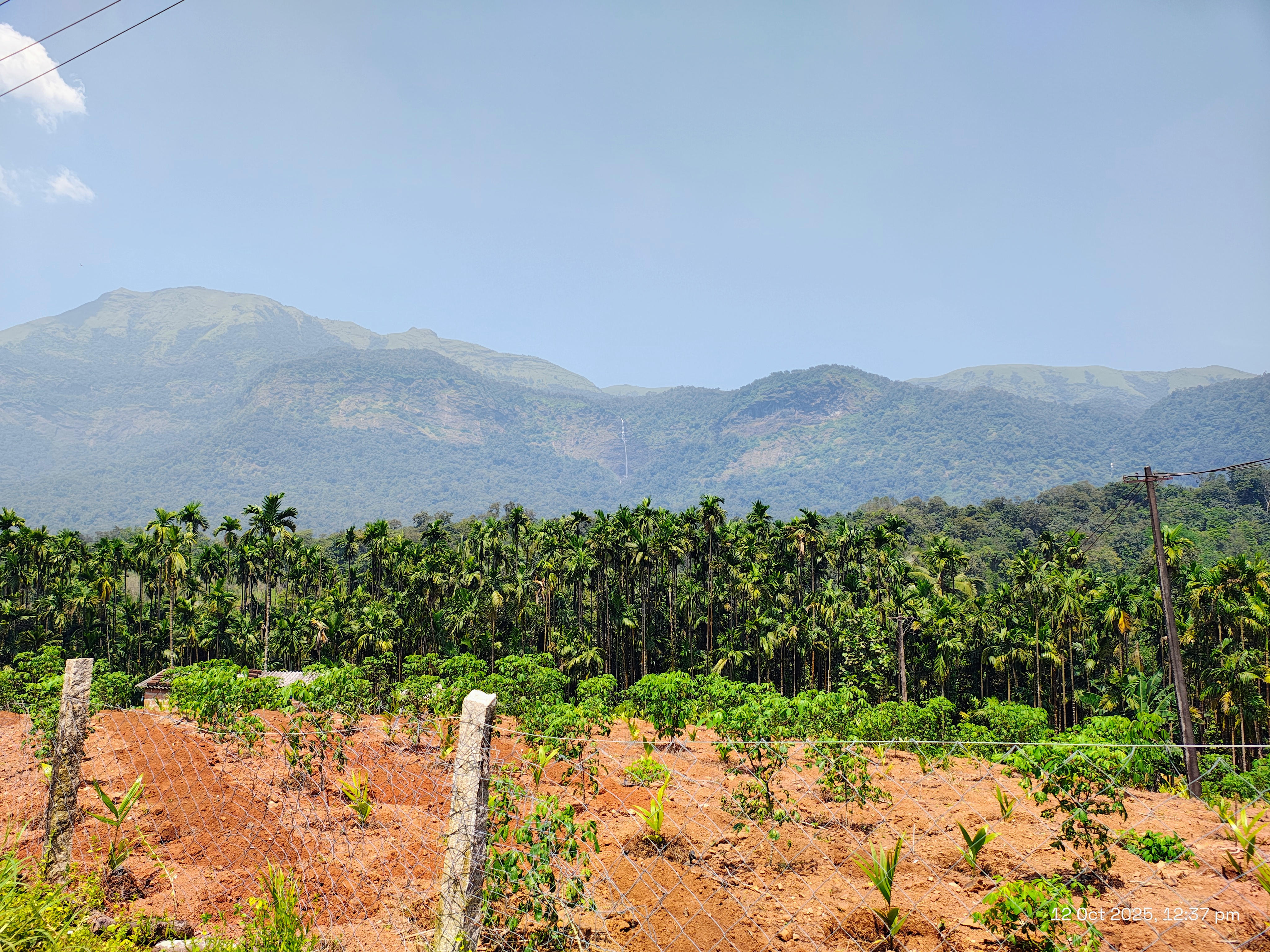
Kodachadri Hills is one of the most important mountain destinations in the Western Ghats around Byndoor and Kollur. Rising to about 1,343 metres above sea level, Kodachadri is known for its thick forests, grass-covered mountain slopes, misty weather and wide views across the Western Ghats. The hill is also deeply connected with the religious traditions of Kollur Mookambika and the spiritual legacy of Adi Shankaracharya.
The character of Kodachadri changes with the weather. On a clear day, the summit opens up to distant mountain ranges and, from suitable viewpoints, views towards the Arabian Sea. When clouds and mist move across the hills, the landscape becomes quieter and more atmospheric, with the surrounding peaks appearing and disappearing through the mist.
Kodachadri is closely associated with Goddess Mookambika and the sacred landscape of Kollur. The hill rises above the forests surrounding the Mookambika Temple, and the temple and mountain are traditionally regarded as part of the same spiritual landscape.
The summit is home to the Sarvajna Peetha, a small stone shrine traditionally associated with Adi Shankaracharya. According to local tradition, Shankaracharya meditated here. The place is therefore visited not only by trekkers but also by pilgrims interested in the spiritual history of the region.
For many visitors, the best way to experience Kodachadri is on foot.
The trekking routes pass through dense forest, grasslands, mountain slopes and open viewpoints. The landscape changes considerably as you climb: sections of thick forest give way to more open hilltop terrain, where the views become much wider.
One popular approach passes through Hidlumane Falls, making it possible to combine a waterfall experience with the mountain trek. The trek is generally considered moderate to challenging, and the total walking distance varies depending on the route used.
Kodachadri can also be reached by jeep, which is useful for visitors who want to experience the hill without completing the full trek. The final mountain road is rough and uneven, and local jeep services are commonly used for the ascent.
Hidlumane Falls is one of the natural highlights associated with the Kodachadri trekking route. The waterfall comes down through the forest in a series of rocky sections and is particularly attractive during and after the monsoon.
For trekkers, the combination of forest trail + waterfall + mountain summit makes the journey more varied than a straightforward climb.
The summit is one of the main reasons people make the journey to Kodachadri.
From the higher slopes, the landscape opens towards the surrounding Western Ghats. On clear days, the distant Arabian Sea can be seen towards the west, while layers of green hills extend in other directions.
Sunrise and sunset are particularly beautiful when visibility is good. During the monsoon, however, clouds and mist can completely cover the distant views, replacing the panorama with a very different but equally memorable mountain atmosphere.
Kodachadri lies within the wider Mookambika Wildlife Sanctuary, a large protected forest landscape containing evergreen, semi-evergreen and moist deciduous forests. The sanctuary provides habitat for a variety of wildlife and birds, and the forests around Kodachadri form an important part of this ecosystem.
Visitors may notice the difference between the lower forest and the more open summit landscape. The mountain supports a variety of vegetation adapted to the high-rainfall Western Ghats environment.
Because it is a protected and ecologically sensitive region, visitors should avoid disturbing wildlife, picking plants or leaving waste behind.
The monsoon gives Kodachadri a completely different appearance. The hills become intensely green, streams fill up and waterfalls become more active. Mist frequently covers the upper slopes, creating the characteristic cloudy atmosphere associated with the mountain.
At the same time, monsoon trekking requires considerably more care. The trails become muddy and slippery, streams can rise quickly and visibility can fall suddenly. Visitors should check the current conditions before starting the trek.
For trekking and clearer views, October to February is generally a comfortable period. The landscape remains green after the monsoon while the trails are usually more manageable than during the peak rainy season.
The monsoon months are ideal for experiencing the lush side of Kodachadri and its waterfalls, but they are not the easiest time for trekking.
Kollur is the natural base for exploring Kodachadri. Many visitors combine the mountain trip with a visit to Sri Mookambika Temple, creating a journey that brings together pilgrimage and Western Ghats scenery.
The relationship between the two places is particularly strong: Kollur represents the temple and river landscape below, while Kodachadri rises above it as the sacred mountain landscape.
Kodachadri has an unusual ability to appeal to very different kinds of visitors.
A pilgrim may come because of the connection with Mookambika and Adi Shankaracharya. A trekker may come for the forest trails and summit. A nature lover may come for the waterfalls and biodiversity. Someone travelling with family may simply take a jeep to the upper hills to enjoy the scenery.
All of these experiences are part of Kodachadri's character.
Kodachadri is much more than a viewpoint or trekking peak. It is a place where mountains, rainforest, waterfalls, wildlife and spiritual traditions meet.
The changing scenery is perhaps its greatest attraction. You can begin among the forests, pass streams and waterfalls, climb through open grasslands and eventually reach a mist-covered summit with views stretching towards the Arabian Sea.
For visitors exploring the Byndoor–Kollur region, Kodachadri provides the perfect contrast to the coastal destinations: instead of looking out across the sea from the shore, here you climb into the Western Ghats and look back towards the coast from the mountains.
ಕೊಡಚಾದ್ರಿ ಬೆಟ್ಟ
ಬೈಂದೂರು ಮತ್ತು ಕೊಲ್ಲೂರು ಭಾಗದ ಪ್ರಕೃತಿಯನ್ನು ಹೇಳುವಾಗ ಕೊಡಚಾದ್ರಿ ಬೆಟ್ಟವನ್ನು ಬಿಟ್ಟು ಹೇಳಲು ಸಾಧ್ಯವಿಲ್ಲ. ಪಶ್ಚಿಮ ಘಟ್ಟದ ಪ್ರಮುಖ ಬೆಟ್ಟಶ್ರೇಣಿಗಳಲ್ಲೊಂದಾದ ಕೊಡಚಾದ್ರಿ, ದಟ್ಟ ಕಾಡು, ಹಸಿರು ಬೆಟ್ಟದ ಇಳಿಜಾರು, ಮಂಜು, ಮೋಡ ಮತ್ತು ವಿಶಾಲವಾದ ನೋಟಗಳಿಂದ ತನ್ನದೇ ಆದ ಸ್ಥಾನ ಹೊಂದಿದೆ.
ಕೊಡಚಾದ್ರಿಯ ಶಿಖರವು ಸಮುದ್ರಮಟ್ಟದಿಂದ 1,343 ಮೀಟರ್ (4,406 ಅಡಿ) ಎತ್ತರದಲ್ಲಿದೆ. ಶಿಖರದ ಮೇಲಿನಿಂದ ಸುತ್ತಲಿನ ಪಶ್ಚಿಮ ಘಟ್ಟದ ಬೆಟ್ಟಗಳು ಹಲವು ದಿಕ್ಕುಗಳಲ್ಲಿ ಹರಡಿಕೊಂಡಿರುವುದನ್ನು ನೋಡಬಹುದು. ಆಕಾಶ ಸ್ವಚ್ಛವಾಗಿರುವ ದಿನಗಳಲ್ಲಿ ಪಶ್ಚಿಮ ದಿಕ್ಕಿನ ದೂರದಲ್ಲಿ ಅರಬ್ಬಿ ಸಮುದ್ರದ ಭಾಗವೂ ಕಾಣಿಸುತ್ತದೆ.
ಕೊಡಚಾದ್ರಿಯ ವಿಶೇಷತೆ ಅದರ ಎತ್ತರದಲ್ಲಿ ಮಾತ್ರ ಇಲ್ಲ. ಬೆಟ್ಟದ ಕೆಳಭಾಗದಿಂದ ಮೇಲಕ್ಕೆ ಸಾಗಿದಂತೆ ಪ್ರಕೃತಿಯ ಸ್ವರೂಪ ಬದಲಾಗುತ್ತಾ ಹೋಗುತ್ತದೆ. ದಟ್ಟ ಕಾಡು, ಬೆಟ್ಟದ ಇಳಿಜಾರು, ಹುಲ್ಲುಗಾವಲು, ಕಲ್ಲಿನ ಪ್ರದೇಶ ಮತ್ತು ಮೇಲ್ಭಾಗದಲ್ಲಿ ಹೆಚ್ಚಾಗುವ ಮಂಜು — ಇವೆಲ್ಲವೂ ಕೊಡಚಾದ್ರಿಯ ಪ್ರವಾಸವನ್ನು ವಿಭಿನ್ನವಾಗಿಸುತ್ತವೆ.
ಮಳೆಗಾಲದಲ್ಲಿ ಕೊಡಚಾದ್ರಿಯ ಸುತ್ತಲಿನ ಕಾಡು ಇನ್ನಷ್ಟು ದಟ್ಟ ಹಸಿರಾಗುತ್ತದೆ. ಬೆಟ್ಟದ ಮೇಲ್ಭಾಗಕ್ಕೆ ಮೋಡಗಳು ಇಳಿದು ಬಂದಾಗ ಕೆಲವೊಮ್ಮೆ ಸುತ್ತಲಿನ ದೃಶ್ಯವೇ ಮಂಜಿನಲ್ಲಿ ಮರೆಯಾಗುತ್ತದೆ. ಅದೇ ಮಂಜು ಸರಿದಾಗ ಏಕಾಏಕಿ ತೆರೆದುಕೊಳ್ಳುವ ಬೆಟ್ಟಗಳ ದೃಶ್ಯ ಕೊಡಚಾದ್ರಿಯ ವಿಶೇಷ ಅನುಭವ.
ಕೊಡಚಾದ್ರಿ ಮತ್ತು ಕೊಲ್ಲೂರು ಶ್ರೀ ಮೂಕಾಂಬಿಕಾ ಕ್ಷೇತ್ರವನ್ನು ಬೇರ್ಪಡಿಸಿ ನೋಡುವುದು ಕಷ್ಟ. ಮೂಕಾಂಬಿಕಾ ವನ್ಯಜೀವಿ ಅಭಯಾರಣ್ಯದ ಪ್ರಮುಖ ಭಾಗವಾಗಿರುವ ಕೊಡಚಾದ್ರಿ, ಕೊಲ್ಲೂರು ಕ್ಷೇತ್ರದ ಪ್ರಕೃತಿ ಹಿನ್ನೆಲೆಯಾಗಿ ನಿಂತಿದೆ.
ಕ್ಷೇತ್ರದ ಸ್ಥಳಪುರಾಣದಲ್ಲಿ ಕೊಡಚಾದ್ರಿಗೆ ವಿಶೇಷ ಸ್ಥಾನವಿದೆ. ಮೂಕಾಂಬಿಕಾ ದೇವಿಯು ಇಲ್ಲಿ ತಪಸ್ಸು ಮಾಡಿದಳು ಎಂಬ ನಂಬಿಕೆ ಇದೆ. ಇದು ಪುರಾಣ ಮತ್ತು ಕ್ಷೇತ್ರದ ನಂಬಿಕೆಯ ಭಾಗವಾಗಿದ್ದು, ಕೊಡಚಾದ್ರಿಯ ಆಧ್ಯಾತ್ಮಿಕ ಮಹತ್ವಕ್ಕೆ ಪ್ರಮುಖ ಕಾರಣವಾಗಿದೆ.
ಹೀಗಾಗಿ ಕೊಡಚಾದ್ರಿಗೆ ಬರುವವರಲ್ಲಿ ಪ್ರಕೃತಿ ಮತ್ತು ಚಾರಣಕ್ಕಾಗಿ ಬರುವವರ ಜೊತೆಗೆ ಮೂಕಾಂಬಿಕಾ ಕ್ಷೇತ್ರದೊಂದಿಗೆ ಅದರ ಸಂಬಂಧವನ್ನು ಅನುಭವಿಸಲು ಬರುವವರೂ ಇದ್ದಾರೆ.
ಕೊಡಚಾದ್ರಿ ಶಿಖರದ ಪ್ರಮುಖ ಸ್ಥಳಗಳಲ್ಲಿ ಸರ್ವಜ್ಞ ಪೀಠವೂ ಒಂದು. ಇಲ್ಲಿನ ಸ್ಥಳೀಯ ಪರಂಪರೆಯಲ್ಲಿ ಇದನ್ನು ಆದಿ ಶಂಕರಾಚಾರ್ಯರ ಧ್ಯಾನಕ್ಕೆ ಸಂಬಂಧಿಸಿದ ಸ್ಥಳವೆಂದು ಗೌರವಿಸಲಾಗುತ್ತದೆ.
ಶಿಖರದ ವಿಶಾಲ ಪ್ರಕೃತಿ ಪರಿಸರದ ನಡುವೆ ಇರುವ ಈ ಸಣ್ಣ ಪೀಠವು ಕೊಡಚಾದ್ರಿಯ ಆಧ್ಯಾತ್ಮಿಕ ಗುರುತಿನ ಪ್ರಮುಖ ಭಾಗವಾಗಿದೆ. ಕೊಡಚಾದ್ರಿಗೆ ಬರುವವರು ಶಿಖರದ ನೈಸರ್ಗಿಕ ದೃಶ್ಯಗಳ ಜೊತೆಗೆ ಈ ಸ್ಥಳವನ್ನೂ ನೋಡುತ್ತಾರೆ.
ಕೊಡಚಾದ್ರಿಯ ಮತ್ತೊಂದು ದೊಡ್ಡ ಆಕರ್ಷಣೆ ಅದರ ಚಾರಣ ಮಾರ್ಗ. ಬೆಟ್ಟದ ಮೇಲಕ್ಕೆ ಹೋಗುವ ದಾರಿಯಲ್ಲಿ ಕಾಡಿನ ಭಾಗಗಳು, ಹುಲ್ಲುಗಾವಲು, ಕಲ್ಲಿನ ಹಾದಿಗಳು ಮತ್ತು ಬೆಟ್ಟದ ಇಳಿಜಾರುಗಳು ಎದುರಾಗುತ್ತವೆ.
ನಿಟ್ಟೂರು ಭಾಗದಿಂದ ಶಿಖರದ ಕಡೆಗೆ ಸಾಗುವ ಚಾರಣ ಮಾರ್ಗ ಪ್ರಕೃತಿಯ ವಿವಿಧ ರೂಪಗಳನ್ನು ಪರಿಚಯಿಸುತ್ತದೆ. ದಾರಿಯಲ್ಲಿ ದಟ್ಟ ಕಾಡಿನ ನೆರಳಿನಿಂದ ಹೊರಬಂದು ತೆರೆದ ಹುಲ್ಲುಗಾವಲು ಪ್ರದೇಶಕ್ಕೆ ಬಂದಾಗ ದೃಶ್ಯ ಸಂಪೂರ್ಣವಾಗಿ ಬದಲಾಗುತ್ತದೆ. ಮೇಲಕ್ಕೆ ಹೋದಂತೆ ಸುತ್ತಲಿನ ಬೆಟ್ಟಗಳ ನೋಟವೂ ವಿಸ್ತಾರವಾಗುತ್ತದೆ.
ಕೊಡಚಾದ್ರಿಯ ಚಾರಣವು ಕೇವಲ ಶಿಖರ ತಲುಪುವುದಕ್ಕಾಗಿ ಮಾಡುವ ನಡಿಗೆಯಲ್ಲ. ದಾರಿಯುದ್ದಕ್ಕೂ ಬದಲಾಗುವ ಭೂಪ್ರದೇಶವೇ ಅದರ ಪ್ರಮುಖ ಆಕರ್ಷಣೆ.
ಕೊಡಚಾದ್ರಿಯ ಮೇಲ್ಭಾಗಕ್ಕೆ ಹೋಗುವ ದಾರಿಯಲ್ಲಿ ಜೀಪ್ ಪ್ರಯಾಣಕ್ಕೂ ಅವಕಾಶವಿದೆ. ಬೆಟ್ಟದ ಕಲ್ಲಿನ ಮತ್ತು ಏರುಪೇರು ಇರುವ ದಾರಿಯಲ್ಲಿ ಜೀಪ್ ಸಾಗುವಾಗ ಪ್ರಯಾಣವೇ ಒಂದು ಸಾಹಸಮಯ ಅನುಭವವಾಗುತ್ತದೆ.
ಒಂದು ಕಡೆ ಕಾಡಿನೊಳಗಿನ ದಾರಿ, ಇನ್ನೊಂದು ಕಡೆ ತೆರೆದ ಬೆಟ್ಟದ ಪ್ರದೇಶ — ದಾರಿಯ ಸ್ವರೂಪ ಪದೇಪದೇ ಬದಲಾಗುತ್ತದೆ. ಆದರೆ ಪ್ರಕೃತಿಯ ಅನುಭವವನ್ನು ಹತ್ತಿರದಿಂದ ಪಡೆಯಲು ಬಯಸುವವರಿಗೆ ಚಾರಣದ ದಾರಿ ಹೆಚ್ಚು ವಿಶೇಷ.
ಕೊಡಚಾದ್ರಿ ಪ್ರವಾಸವನ್ನು ಕೇವಲ ಶಿಖರಕ್ಕೆ ಸೀಮಿತಗೊಳಿಸಬೇಕಾಗಿಲ್ಲ. ಹಿಡ್ಲುಮನೆ ಜಲಪಾತವೂ ಕೊಡಚಾದ್ರಿಯ ಚಾರಣ ಮಾರ್ಗದ ಪ್ರಮುಖ ಪ್ರಕೃತಿ ಆಕರ್ಷಣೆಗಳಲ್ಲಿ ಒಂದು. ಬೆಟ್ಟ ಮತ್ತು ಕಾಡಿನ ನಡುವೆ ಸಾಗುವ ದಾರಿಯಲ್ಲಿ ಜಲಧಾರೆಯನ್ನು ಸೇರಿಸಿಕೊಳ್ಳುವುದು ಕೊಡಚಾದ್ರಿಯ ಪ್ರಕೃತಿ ಅನುಭವವನ್ನು ಮತ್ತಷ್ಟು ವಿಸ್ತರಿಸುತ್ತದೆ.
ಮಳೆಗಾಲದಲ್ಲಿ ಈ ಭಾಗದ ನೀರಿನ ಹರಿವು ಹೆಚ್ಚಾಗುವುದರಿಂದ ಕಾಡು ಮತ್ತು ಜಲಪಾತ ಎರಡೂ ಹೆಚ್ಚು ಜೀವಂತವಾಗಿ ಕಾಣುತ್ತವೆ.
ಕೊಡಚಾದ್ರಿಯ ಅತ್ಯಂತ ನೆನಪಿನಲ್ಲಿ ಉಳಿಯುವ ದೃಶ್ಯಗಳಲ್ಲಿ ಮಂಜು ಕೂಡ ಒಂದು. ಮೇಲ್ಭಾಗದಲ್ಲಿ ಹವಾಮಾನ ಬದಲಾಗುವಂತೆ ಕೆಲವೇ ನಿಮಿಷಗಳಲ್ಲಿ ಸುತ್ತಲಿನ ಬೆಟ್ಟಗಳು ಕಾಣಿಸಿಕೊಳ್ಳಬಹುದು ಅಥವಾ ಸಂಪೂರ್ಣವಾಗಿ ಮಂಜಿನಲ್ಲಿ ಮುಚ್ಚಿಕೊಳ್ಳಬಹುದು.
ಕೆಲವೊಮ್ಮೆ ಶಿಖರದಲ್ಲಿ ನಿಂತಾಗ ಮುಂದೆ ಕೆಲವು ಮೀಟರ್ಗಳಷ್ಟು ಮಾತ್ರ ಕಾಣಬಹುದು. ಮತ್ತೆ ಮಂಜು ಸರಿದಾಗ ದೂರದ ಬೆಟ್ಟಗಳು, ಕಣಿವೆಗಳು ಮತ್ತು ಆಕಾಶ ಒಂದೇ ಬಾರಿ ತೆರೆದುಕೊಳ್ಳುತ್ತವೆ.
ಇದೇ ಬದಲಾವಣೆ ಕೊಡಚಾದ್ರಿಯ ಸೌಂದರ್ಯವನ್ನು ಮತ್ತಷ್ಟು ವಿಶೇಷವಾಗಿಸುತ್ತದೆ.
ಕೊಡಚಾದ್ರಿಯ ಮೇಲ್ಭಾಗದಿಂದ ಕಾಣುವ ಸೂರ್ಯೋದಯ ಮತ್ತು ಸೂರ್ಯಾಸ್ತವೂ ಇಲ್ಲಿನ ಪ್ರಮುಖ ಆಕರ್ಷಣೆಗಳಲ್ಲಿ ಒಂದು. ಮುಂಜಾನೆ ಬೆಟ್ಟಗಳ ಮೇಲೆ ಬೆಳಕು ಹರಡಿಕೊಳ್ಳುವ ದೃಶ್ಯ ಮತ್ತು ಸಂಜೆ ಸೂರ್ಯ ನಿಧಾನವಾಗಿ ಕೆಳಗೆ ಇಳಿಯುವಾಗ ಆಕಾಶದ ಬಣ್ಣ ಬದಲಾಗುವ ದೃಶ್ಯ ಎರಡೂ ವಿಭಿನ್ನ ಅನುಭವ ನೀಡುತ್ತವೆ.
ಪಶ್ಚಿಮ ಭಾಗದ ಕಡೆಗೆ ತೆರೆದಿರುವ ಪ್ರದೇಶಗಳಿಂದ ಸಂಜೆ ವೇಳೆ ದೂರದ ಅರಬ್ಬಿ ಸಮುದ್ರದ ದಿಕ್ಕಿನ ಆಕಾಶವೂ ಕಾಣಿಸುತ್ತದೆ. ಹವಾಮಾನ ಸ್ವಚ್ಛವಾಗಿದ್ದರೆ ಬೆಟ್ಟಗಳ ಮೇಲಿನಿಂದ ಸಮುದ್ರದ ದಿಕ್ಕಿನವರೆಗಿನ ವಿಶಾಲ ನೋಟ ಸಿಗುತ್ತದೆ.
ಕೊಡಚಾದ್ರಿ ಸುತ್ತಲಿನ ಪ್ರದೇಶ ಮೂಕಾಂಬಿಕಾ ವನ್ಯಜೀವಿ ಅಭಯಾರಣ್ಯದ ಭಾಗವಾಗಿದೆ. ಈ ಅರಣ್ಯ ಪ್ರದೇಶದಲ್ಲಿ ನಿತ್ಯಹರಿದ್ವರ್ಣ ಮತ್ತು ಅರೆ-ನಿತ್ಯಹರಿದ್ವರ್ಣ ಕಾಡುಗಳು ಕಂಡುಬರುತ್ತವೆ. ಹುಲಿ, ಕಾಡುನಾಯಿ, ಕರಡಿ, ಕಾಡುಹಂದಿ, ಜಿಂಕೆ ಸೇರಿದಂತೆ ವಿವಿಧ ವನ್ಯಜೀವಿಗಳು ಹಾಗೂ ಹಲವು ಪಕ್ಷಿ ಪ್ರಭೇದಗಳು ಈ ಅರಣ್ಯ ವ್ಯವಸ್ಥೆಯ ಭಾಗವಾಗಿವೆ.
ಚಾರಣದ ವೇಳೆ ಕಾಡಿನ ಸಸ್ಯವರ್ಗ ಮತ್ತು ಪಕ್ಷಿಗಳ ಧ್ವನಿಯನ್ನು ಗಮನಿಸುವುದು ಕೂಡ ಕೊಡಚಾದ್ರಿಯ ಪ್ರಕೃತಿ ಅನುಭವದ ಒಂದು ಭಾಗ. ಆದರೆ ಇದು ಅರಣ್ಯ ಪ್ರದೇಶವಾಗಿರುವುದರಿಂದ ಕಾಡಿನ ಜೀವಿಗಳಿಗೆ ತೊಂದರೆ ಕೊಡದೆ, ಕಸ ಹಾಕದೆ ಸಾಗುವುದು ಬಹಳ ಮುಖ್ಯ.
ಮಳೆಗಾಲದಲ್ಲಿ ಕೊಡಚಾದ್ರಿ ಸಂಪೂರ್ಣವಾಗಿ ಬೇರೆ ರೂಪ ಪಡೆಯುತ್ತದೆ. ಬೆಟ್ಟದ ಇಳಿಜಾರುಗಳು ಹಸಿರಾಗುತ್ತವೆ, ಸಣ್ಣ ತೊರೆಗಳು ತುಂಬುತ್ತವೆ ಮತ್ತು ಶಿಖರದ ಸುತ್ತ ಮೋಡ–ಮಂಜು ಹೆಚ್ಚಾಗುತ್ತದೆ.
ಆದರೆ ಇದೇ ಸಮಯದಲ್ಲಿ ಚಾರಣದ ಹಾದಿಗಳು ಹೆಚ್ಚು ಜಾರುವಂತಾಗುತ್ತವೆ. ಮಣ್ಣು, ಕಲ್ಲು ಮತ್ತು ನೀರಿನ ಹರಿವುಗಳಿಂದ ದಾರಿ ಕಷ್ಟಕರವಾಗಬಹುದು. ಆದ್ದರಿಂದ ಮಳೆಗಾಲದ ಕೊಡಚಾದ್ರಿ ಅದ್ಭುತವಾಗಿ ಕಾಣಿಸಿದರೂ, ಬೆಟ್ಟದ ಪರಿಸ್ಥಿತಿಯನ್ನು ಗಮನದಲ್ಲಿಟ್ಟುಕೊಂಡೇ ಚಾರಣ ಮಾಡಬೇಕು.
ಕೊಡಚಾದ್ರಿಯ ಮತ್ತೊಂದು ವಿಶೇಷತೆ ಅದರ ಭೌಗೋಳಿಕ ಸ್ಥಾನ. ಕರಾವಳಿ ಕರ್ನಾಟಕದಿಂದ ಪಶ್ಚಿಮ ಘಟ್ಟದ ಒಳಭಾಗಕ್ಕೆ ಸಾಗಿದಾಗ ಕಾಣುವ ಪ್ರಕೃತಿಯ ಬದಲಾವಣೆಯನ್ನು ಇಲ್ಲಿ ಸ್ಪಷ್ಟವಾಗಿ ಅನುಭವಿಸಬಹುದು.
ಬೈಂದೂರು ಮತ್ತು ಕೊಲ್ಲೂರು ಭಾಗದ ಕೆಳಭೂಮಿಯಿಂದ ಮೇಲಕ್ಕೆ ನೋಡಿದಾಗ ಸಾಮಾನ್ಯ ಬೆಟ್ಟದಂತೆ ಕಾಣುವ ಕೊಡಚಾದ್ರಿ, ಅದರ ಮೇಲಕ್ಕೆ ಹೋದಾಗ ಸಂಪೂರ್ಣ ಬೇರೆ ಜಗತ್ತಿನಂತೆ ಕಾಣುತ್ತದೆ. ಕೆಳಗೆ ಕಾಡು, ಮಧ್ಯದಲ್ಲಿ ಬೆಟ್ಟದ ಇಳಿಜಾರು ಮತ್ತು ಮೇಲ್ಭಾಗದಲ್ಲಿ ಹುಲ್ಲುಗಾವಲು ಹಾಗೂ ಮೋಡಗಳ ನಡುವೆ ಇರುವ ಶಿಖರ — ಈ ಬದಲಾವಣೆ ಅದರ ದೊಡ್ಡ ಆಕರ್ಷಣೆ.
ಕೊಡಚಾದ್ರಿಯನ್ನು ವಿಶೇಷವಾಗಿಸುವುದು 1,343 ಮೀಟರ್ ಎತ್ತರದ ಶಿಖರ ಮಾತ್ರವಲ್ಲ. ಮೂಕಾಂಬಿಕಾ ಕ್ಷೇತ್ರದೊಂದಿಗೆ ಬೆಸೆದುಕೊಂಡಿರುವ ಪುರಾಣ ಪರಂಪರೆ, ಸರ್ವಜ್ಞ ಪೀಠದ ಆಧ್ಯಾತ್ಮಿಕ ಮಹತ್ವ, ದಟ್ಟ ಪಶ್ಚಿಮ ಘಟ್ಟದ ಕಾಡು, ಹಿಡ್ಲುಮನೆ ಜಲಪಾತ, ಮಂಜಿನಿಂದ ಆವೃತವಾಗುವ ಶಿಖರ, ಚಾರಣದ ದಾರಿಗಳು ಮತ್ತು ದೂರದ ಅರಬ್ಬಿ ಸಮುದ್ರದವರೆಗಿನ ನೋಟ — ಇವೆಲ್ಲವೂ ಸೇರಿ ಕೊಡಚಾದ್ರಿಗೆ ಅದರದೇ ಆದ ಗುರುತನ್ನು ನೀಡುತ್ತವೆ.
ಬೈಂದೂರು–ಕೊಲ್ಲೂರು ಭಾಗಕ್ಕೆ ಬರುವವರಿಗೆ ಕೊಡಚಾದ್ರಿ ಕೇವಲ ಒಂದು ಬೆಟ್ಟವನ್ನು ಏರುವ ಸ್ಥಳವಲ್ಲ. ಕರಾವಳಿಯಿಂದ ಪಶ್ಚಿಮ ಘಟ್ಟದ ಹೃದಯದವರೆಗೆ ಸಾಗುವ ಪ್ರಕೃತಿ ಮತ್ತು ಆಧ್ಯಾತ್ಮಿಕ ಪ್ರಯಾಣದ ಒಂದು ಪ್ರಮುಖ ಭಾಗವೇ ಕೊಡಚಾದ್ರಿ.
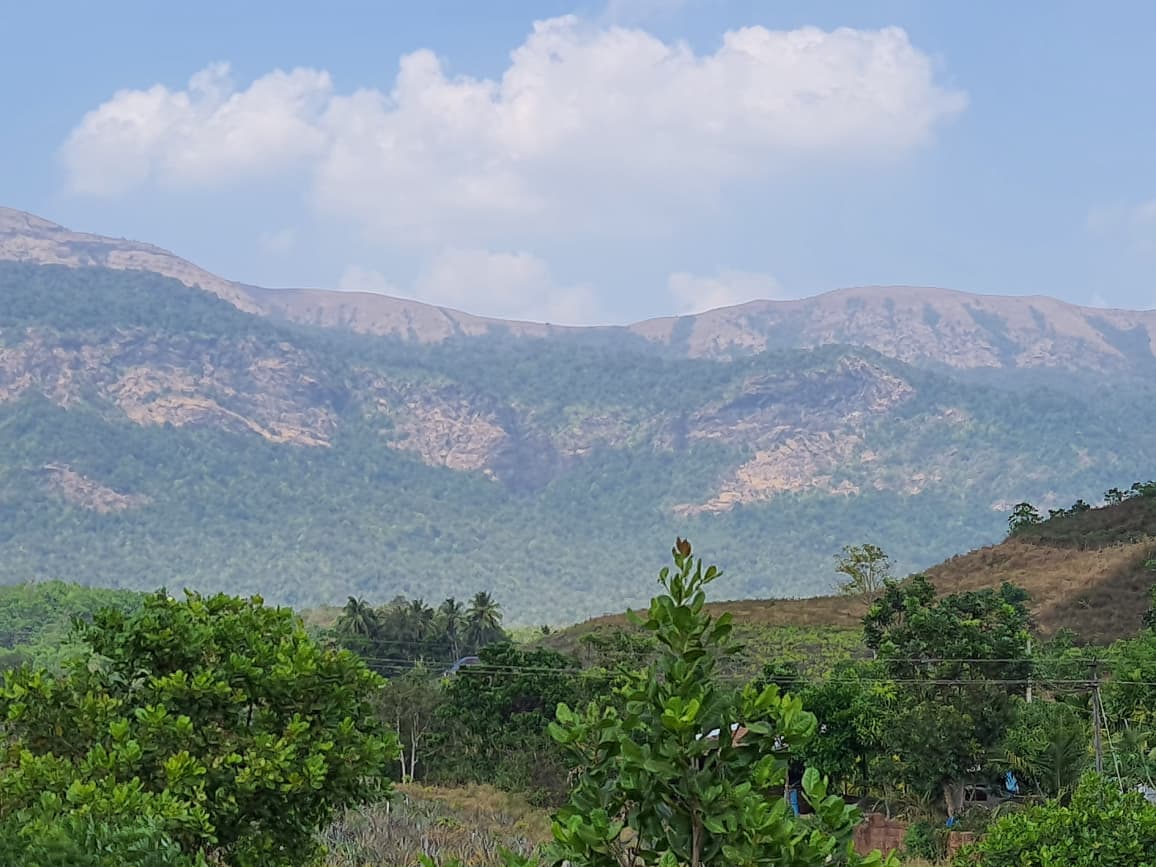
🚗 By road: From Kollur take ghat road -> Nittoor
🚌 By bus: Kollur Hosanagara route buses Sampekatte stop
🚆 By train: Nearest Railway station Byndoor Mookambika Railway Station about 67km
✈️ By air: Mangalore International Airport about 166km
| Mobile network | Low |
|---|---|
| Nearest ATM | Kollur |
Places usually visited on the same trip.